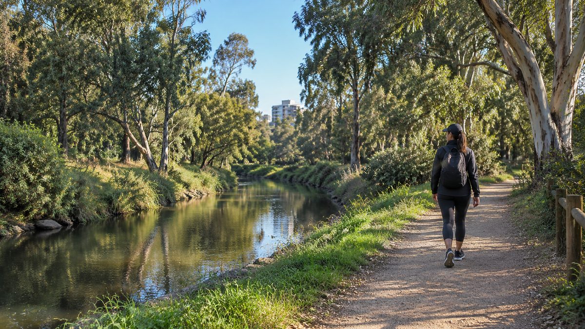
Merri Creek Walks Near Brunswick
The best Merri Creek walks near Brunswick start in Brunswick East and follow the creek north toward Coburg or south toward Clifton Hill. The route is easy to change because bridges, side paths and nearby tram stops give you several places to turn around. For a first visit, start near CERES Community Environment Park and choose your direction based on how much time you have.
The main path is the Merri Creek Trail. It follows the water through a long green corridor beside Brunswick East, a separate suburb neighbouring Brunswick. You can take a short stroll, build a loop through nearby streets or continue for several hours. The useful trick is to plan by time and turning point instead of treating the trail as one fixed walk.
Which stretch gives you the best first walk?
The section between Blyth Street and Moreland Road gives a first-time walker the clearest taste of Merri Creek. It has easy access from Brunswick East, frequent views of the water and enough activity to feel welcoming. The path also passes revegetated banks, open grass and pockets of mature trees.
Begin near CERES Community Environment Park at the eastern end of Blyth Street. Join the creek path and head north. Walk until your planned halfway time, then return by the same route. This removes the risk of making a loop longer than expected. A steady 20 minutes north and 20 minutes back works well when you want a local walk rather than a full outing.
Continue toward Moreland Road if you want more distance. The road crossing forms a clear marker between the Brunswick East section and the paths leading into Coburg, Victoria. You do not need to reach it for the walk to feel complete. The creek has enough bends, bridges and changes in vegetation to make even a short out-and-back worthwhile.
This route suits people who care more about creek scenery than street landmarks. Traffic noise still reaches parts of the corridor, but the land around the water creates a strong break from the surrounding grid. You also avoid the repeated road crossings found on many suburban walks.
Should you walk north or south from Blyth Street?
Walk north for a simple green corridor with clear turnaround points. Walk south if you want a longer route that links with Melbourne's wider trail network.
The northern choice takes you toward Moreland Road and Coburg. It feels easy to manage because you can measure the outing against one obvious destination. The southern choice passes more connecting paths and gradually leads toward the Capital City Trail. That option rewards walkers who enjoy joining several neighbourhoods in one trip.
A practical way to choose is to check the wind before starting. If a cool wind is coming from the south, walk south first so it helps push you home. On a hot day, choose the direction with the best shade at the time you leave. Creek paths can feel cooler than nearby streets, yet exposed sections still become harsh in the afternoon.
People often make the route harder by choosing a distant landmark before seeing how their legs feel. A better rule is to set a return time. If you have one hour, turn after about 25 minutes. That leaves spare time for a slower section, a drink stop or a wrong turn at a bridge.
What are the best route options for different amounts of time?
You can shape the walk around four useful formats. Each uses the same creek corridor but creates a different kind of outing.
A short creek reset
Start at Blyth Street, enter beside CERES and walk north for 10 to 15 minutes. Turn at a bridge or another clear feature. This gives you a 20 to 30 minute walk with almost no planning. It works well before work, after lunch or when younger children need a simple destination.
A one-hour Brunswick East walk
Follow the Merri Creek Trail north from CERES and turn when half your walking time has passed. A normal pace will cover several kilometres in an hour, but path traffic and stops beside the creek can reduce that distance. Treat the clock as the guide. That keeps the walk useful even when the trail is busy.
A northbound walk into Coburg
For a northbound extension, follow current trail signs towards Coburg and use Moreland Road as a mapped reference. Sumner Park is south of CERES, so it is not a northbound landmark beyond Moreland Road. Check current access and closures rather than assuming every mapped connection is open.
A southbound trail connection
Head south from Brunswick East and follow the signed route toward the Capital City Trail. This creates a longer urban walk that can continue toward Clifton Hill, Victoria. It is a better choice when you have several hours or plan to finish near public transport instead of returning on foot.
Do not judge these options only by distance. A five-kilometre creek walk may take longer than the same distance on a footpath. You may slow down at narrow bends, wait for riders to pass or stop to look at birds and the water. Plan around the kind of outing you want, not a target number on a fitness app.
Can you make a loop instead of retracing the trail?
Yes. The simplest loop uses the creek in one direction and local streets for the return. Cross at a bridge that appears on your map, then use the street grid to work back toward your starting point.
A loop gives you more variety, but it also replaces creek shade with harder street surfaces. The return may include busy roads, uneven paving and longer waits at lights. Keep the creek leg as the main part of the walk. Use the street section as a short link rather than sending half the route through traffic.
The area around Brunswick Velodrome can help you form a local loop near the western side of the creek corridor. Check your map for the safest legal crossing and entrance before you commit. Small paths can look connected from a distance while ending at fences, sports grounds or steep banks.
When planning a loop, choose clear mapped anchors such as a named bridge, Blyth Street and your starting point. Check each connecting public street before committing to the return route.
Where does the trail become confusing?
Confusion usually starts where several paths meet, not on the long creekside stretches. A sealed branch may climb toward a street while a narrower path stays near the water. Both can seem like the main route.
Pause at each junction and look for trail signs before moving on. If signs are missing, check whether your map places the creek on your left or right. That one detail often confirms your direction faster than trying to match nearby buildings.
The connection with the Capital City Trail deserves extra attention. Parts of Melbourne's shared trail system overlap or meet, so a familiar-looking path can carry you away from the creek. This matters most on a southbound walk toward Clifton Hill. Check the next named road or bridge rather than relying on the general direction of other walkers.
Creek crossings can also change the feel of the route. One bank may have the through path while the other leads into a park or residential street. Crossing for a better view is fine, but confirm that another bridge lets you return without a long detour.
What is the path like underfoot?
The main route uses sealed shared paths for much of the way, with local access tracks and unsealed side paths in some places. Rain can leave mud, leaf litter and shallow water near low points. Bridges and painted surfaces may also become slick.
Normal walking shoes are enough in dry weather. Choose shoes with a firm sole after rain, and stay on the main path if the bank looks soft. Informal tracks beside the water can erode quickly. They may also place you close to unstable edges or sensitive plants.
Some gradients feel steeper than they appear on a map. The creek sits below the surrounding streets, so access paths often descend sharply and then climb on the return. A route described as flat may still include short ramps at bridges and road links.
After heavy rain, give the creek more space. Fast water can cover low sections and carry debris into the path. A closed gate or warning sign is a reason to turn back. Do not step around a barrier because the visible section looks dry.
How do walkers and riders share the route safely?
Treat the Merri Creek Trail as cycling infrastructure as well as a walking path. Keep left, walk in a predictable line and look behind you before crossing the centre. Riders can approach quickly on slopes and around bends.
If you walk with another person, move into single file when the path narrows. Keep children close at blind corners. A dog lead should be short enough to stop the dog moving across both lanes. Long leads are hard for riders to see and can block the full path in a moment.
Headphones create another risk. Keep the volume low enough to hear a bell or spoken warning. If a rider rings a bell, hold your line instead of jumping sideways. The bell usually means they have seen you and plan to pass.
Busy periods change the pace of the walk. Commuters often use the corridor early in the morning and late in the afternoon. Weekends bring family groups, runners and casual riders. If you want a slower visit, choose a quieter part of the day and leave room for others at stopping points.
What will you notice beside the creek?
The value of this walk comes from watching the city and creek meet. Concrete drains, road bridges and sports areas sit close to reeds, old trees and restored native plants. The contrast explains why the corridor feels different from a formal park.
Look for changes in the water after rain. The creek may turn cloudy and rise fast because stormwater flows from a large urban catchment. Litter can also collect around branches and bridge supports. These signs show that the waterway is linked to streets far beyond the part you can see.
Bird activity changes with the time of day. Quiet walkers may notice small birds in dense plants, waterbirds near open sections and larger birds moving between tall trees. Stop away from the centre of the path so other users can pass.
CERES Community Environment Park adds another layer to the visit. Its gardens, community spaces and environmental focus fit naturally with a creek walk. Check opening details separately if you plan to enter, eat or attend an activity. The trail itself remains the main route, while CERES works best as a start, finish or planned stop.
When is the creek walk most comfortable?
Morning usually gives you cooler air and clearer choices about extending the route. Late afternoon can also work, but darkness reaches shaded creek sections before open streets. Carry a light if your return may run past sunset.
In summer, start early and bring water. Shade shifts through the day and does not cover the full trail. In winter, expect damp leaves, soft edges and cooler air close to the water. After several dry days, the sealed path is generally easier to follow.
Weather upstream matters as much as the sky above Brunswick. Heavy rain across the catchment can raise the creek even when local rain seems mild. Check current warnings and path closures before any walk planned soon after a storm.
Smoke, strong wind and extreme heat are reasons to reconsider an outdoor walk. Check current warnings and avoid closed paths or hazardous tree areas.
How can you plan the walk without overthinking it?
Choose one start point, one direction and one firm turnaround rule. Save the route on your phone before entering the creek corridor, where signs and reception may vary. Tell someone your rough plan if you are taking a long walk alone.
- Start near Blyth Street for direct access to the Brunswick East section.
- Choose north for Moreland Road and Coburg, or south for the Capital City Trail and Clifton Hill.
- Set a time to turn around before you begin.
- Check rain, heat, wind and any current path closure.
- Keep left and leave the centre of the shared path clear.
You can extend the route once you know how the path feels. That first walk teaches you more than a complicated plan: where the shade falls, how busy the trail gets and which crossings make sense to you.
For your next walk, start at Blyth Street, follow Merri Creek north for half your available time, then turn around on the same path.
Trail context: Merri Creek Management Committee’s map shows CERES, Blyth Street, Sumner Park and the wider corridor: https://mcmc.org.au/images/file/Merri%20Creek%20Trail.pdf. This is an older map, so use it for orientation alongside current signs and closure notices, not current transport or opening hours. CERES’ current visitor directions describe its creek-path gate near the Blyth Street/Arthurton Road bridge: https://ceres.org.au/visit/. Times above are estimates for self-planning. Reviewed 11 October 2026.
Explore more local guides at https://brunswicklocal.pages.dev/.
Image: AI-generated editorial illustration; it does not document a particular venue or visit.