Brunswick West Neighbourhood Guide
Brunswick West suits people who want a quiet inner-north home base with useful tram links, local parks and fewer busy retail strips outside their door. It feels more residential than nearby Brunswick, Victoria, yet the two suburbs remain closely linked. Residents can reach larger shopping areas when needed, then return to streets where houses, small apartment blocks and green spaces set the pace.
The suburb rewards careful street-level research. Two homes a few blocks apart can offer very different trips, noise levels and access to shops. The most useful way to judge Brunswick West is to study its transport corridors, creek edge and smaller residential pockets.
Where does Brunswick West fit within inner Melbourne?
Brunswick West sits about six kilometres north-west of the Melbourne central business district. It forms part of the City of Merri-bek and occupies the western side of the wider Brunswick area. Moonee Ponds lies across the creek and major road corridor to the west.
This position gives the suburb two identities. Its eastern side connects closely with Brunswick shops and services. Its western side faces Moonee Ponds Creek, the Tullamarine Freeway and the large road network around Moonee Ponds. The centre feels quieter because most through traffic stays on a limited number of main roads.
The suburb has no single large town centre. Daily life forms around smaller clusters of shops, tram stops, schools and parks. That spread is part of the appeal, but it means an address should be judged by walking distance rather than the suburb name alone.
Which roads shape how the suburb feels?
Melville Road is the main north-south spine. It carries trams, local traffic and a series of small businesses. Living near it can cut the walk to public transport, food and basic services. A home directly on the road may receive more traffic noise than one around the corner.
Grantham Street serves the eastern side and helps connect Brunswick West with central Brunswick. Its surrounding blocks often feel closer to Sydney Road services than a map of the suburb suggests. The trade-off is that trips towards the west can take longer on foot because the suburb is wider than it first appears.
The Tullamarine Freeway shapes the western edge. As a Controlled-access highway, it provides fast car access towards Melbourne Airport and the city road network. It also creates a firm barrier between some residential streets and places on the other side. A destination that looks close in a straight line may require a specific bridge or underpass.
Road access should be tested at the time you expect to travel. A clear Sunday drive says little about a weekday peak. The same rule applies to parking. Inspect the signs on the exact block because restrictions and demand can change near tram stops, schools and apartment buildings.
How useful are the tram links in real life?
Route 58 is the key public transport service for much of Brunswick West. It runs along Melville Road and links the area with Royal Park, inner-city stops and the central city. For residents within a short walk, it provides a direct trip without needing to change services.
Melbourne tram route 59 is useful from the western side of the wider area, especially for people who can reach stops near Mount Alexander Road in Moonee Ponds. It offers another path towards the city and serves destinations along the way. It will not be the closest choice for every Brunswick West address, so check the full walk rather than comparing tram lines alone.
Tram access works best when the stop is easy to reach in rain, after dark and while carrying shopping. A distance of 700 metres can feel short on paper. It feels much longer if the route crosses a busy road or climbs a slope.
People who commute to the Melbourne central business district should test the door-to-door journey during peak time. Include the walk, expected wait and final leg from the city stop. That gives a more useful result than the scheduled tram time by itself.
Can you manage daily life without a car?
Yes, if you choose a home near Melville Road, Grantham Street or a practical route into Brunswick. Residents farther from those corridors may still live without a car, but they need to plan food shopping and late-night travel with more care.
The suburb works well for mixed travel. A resident might use Route 58 for work, walk to a local park and take a short bike ride for a larger grocery shop. This is often easier than expecting one nearby strip to meet every need.
Cycling can make the suburb much more useful. The Moonee Ponds Creek corridor provides a largely separated path that links with other routes. Access points matter. Check whether the nearest entrance is on the correct side of the creek and whether it stays open at the hours you need.
Drivers gain quick access to major roads, but that access has a cost. Traffic builds around freeway entries and key crossings. If airport trips are common, the western side may be handy. If most weekly errands are in central Brunswick, an eastern address may save more time overall.
What kind of housing will you see?
Brunswick West contains older detached homes, post-war houses, townhouses and apartments of different ages. Many streets mix several building types within one block. This creates more choice than a suburb filled with one housing style, though build quality varies.
Older homes may offer larger rooms, established gardens and more separation from neighbours. Check insulation, drainage and past alterations. A fresh coat of paint does not reveal how a house handles a cold morning or heavy rain.
Townhouses can provide a lower-maintenance option while keeping a private entrance or small outdoor area. Inspect turning space, shared driveways and the position of neighbouring windows. Those details affect daily comfort more than staged furniture.
Apartment buyers and renters should check owners corporation records where available, construction dates, ventilation and waste collection. Listen from the bedroom with the windows open. Traffic, garage doors and shared entry noise can change the feel of an otherwise good property.
Which pockets suit different daily routines?
The Melville Road pocket suits people who place direct tram access first. It also offers small local shops and quick movement through the suburb. Look one or two streets back if you want the transport benefit with less road noise.
The eastern pocket near Grantham Street works well for people who use Brunswick services often. It can shorten trips to larger retail strips, gyms and food options outside Brunswick West. Some blocks also offer a straightforward ride towards the Upfield corridor.
The creek-side pocket appeals to walkers, runners and cyclists who expect to use the Moonee Ponds Creek trail each week. Green views and fewer through streets can feel calm. The freeway, creek crossings and evening lighting should be checked before choosing a home there.
The northern residential area around Dunstan Reserve offers useful open space and a quieter street pattern in many parts. It can suit households that value room for outdoor exercise more than being beside a major shopping strip. Distance to the nearest tram stop still varies from block to block.
There is no universal best pocket. The best one removes friction from the trip you make most often. A beautiful street loses its shine when every workday begins with an awkward connection.
Where can residents spend time outdoors?
Dunstan Reserve is one of the suburb's main recreation spaces. Its broad grounds support organised sport, casual exercise and time outside. Homes near the reserve gain easy access, though match days can bring activity, lights and parking demand.
Smaller local reserves can make a short outdoor break easier. Check their current council listings and inspect paths and road crossings rather than relying on straight-line distance.
The Moonee Ponds Creek corridor offers a longer route for cycling, walking and running. It feels different from a formal sports ground because the path keeps moving through the wider area. Weather and creek conditions can affect sections after heavy rain, so regular users should learn alternate access points.
Green space should be judged by fit. A sports field, play area and linear trail serve different needs. Visit the place you expect to use at the hour you would normally go. That reveals lighting, crowd levels and traffic around the entrances.
Where do people handle shopping and meals?
Brunswick West has useful local businesses along its main corridors, but it is not built around one dense shopping centre. Small grocers, cafes and service businesses cover many routine needs. Larger shopping trips often lead east into Brunswick or west towards Moonee Ponds.
This pattern can be a strength for residents who prefer calm streets and accept a short trip for more choice. It can frustrate someone who expects a supermarket, late dinner and specialist services within a five-minute walk.
Before moving, map the services you use every week. Include the grocery store you can afford, your preferred pharmacy and any regular health service. Then test those routes on foot or by public transport. Search results often show the nearest business, not the easiest one to reach.
What should families check before choosing a street?
Families should begin with crossings, play space and the daily route to school or care. A nearby school is less useful if the walk includes a difficult intersection. School zones and enrolment rules can change, so confirm them directly with the relevant school or education authority.
Street slope matters for prams, small children and bike travel. The creek edge and inland streets do not all sit at the same level. Walk the route rather than judging it from a map.
Visit a possible home during school drop-off and again after dinner. Morning traffic reveals parking pressure and turning movements. An evening visit shows lighting, tram sound and how active the street feels once local businesses close.
What should renters and buyers inspect closely?
Start with noise. Properties near Melville Road, the Tullamarine Freeway or busy connector streets may experience steady traffic sound. Check bedrooms and outdoor areas with doors and windows in their normal position.
Next, inspect transport access. Find the nearest stop, read the service frequency and walk the route. Confirm whether the return trip at night uses the same stop or leaves you across a difficult road.
Check water movement around low points, garden levels and basement parking. Buyers should arrange qualified building and pest inspections. Apartment buyers should review maintenance plans and known defects before committing funds.
Finally, look beyond the property boundary. Nearby development can alter sunlight, parking and construction noise. Current planning information from the City of Merri-bek can show applications that may affect the block.
How should you test Brunswick West in one visit?
A useful visit should copy an ordinary day. Start near the home or street you are considering. Walk to the tram stop, then continue to the nearest place where you would buy food. This exposes steep sections, poor crossings and gaps between services.
Spend time at the green space you would use, whether that is Dunstan Reserve, another council-listed reserve or the creek path. Return by a different route so you see the back streets as well as the main corridor.
If driving forms part of your routine, test the path to the Tullamarine Freeway or your usual destination during a busy period. Check where visitors could park and whether bins or narrow driveways reduce usable space.
Finish after sunset. Street lighting, tram noise and the walk from the stop can feel different from a daytime inspection. One focused visit will reveal more than several quick drives through the suburb.
Who will feel most at home here?
Brunswick West best suits people who value a residential setting but still want inner-city access. It works especially well for tram commuters near Route 58, cyclists who use the creek corridor and households that prefer parks over a large nightlife strip.
People who want dense retail at the end of every street may prefer central Brunswick. Frequent cross-city drivers should study peak traffic before committing. Residents who choose a pocket that matches their routine can gain calm streets without giving up practical links.
What should you do next?
- Choose one real address and map your weekday commute.
- Walk from that address to the nearest tram stop and grocery option.
- Visit the same block during peak traffic and after sunset.
- Check noise, parking, crossings and planned development before deciding.
Your single takeaway: judge Brunswick West block by block, using the trip you make most often as the test.
Editorial fact check — 11 October 2026. Brunswick West is distinct from Brunswick. Merri-bek lists Dunstan Reserve at Peacock Street in Brunswick West. Check Route 58, connecting services and disruptions for the exact address. Relative calm, shopping convenience and travel time depend on the street and time of day; they are not measured suburb-wide findings. Sources: https://active.merri-bek.vic.gov.au/sportsgrounds-and-facilities/ and https://transport.vic.gov.au/plan-a-journey/network-maps/melbourne-public-transport-maps.
Explore more local guides at https://brunswicklocal.pages.dev/.
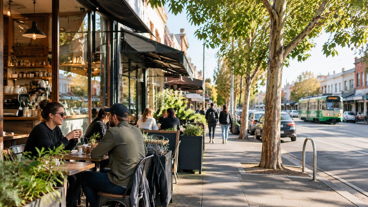
Image: AI-generated editorial illustration; it does not document a particular venue or visit.